
Supported file formats for import
Glint Solar allows you to import files either as a layer or as a project. Any imported data will be available only to users who have access to your account. If you're interested in our country-specific data packages, please contact us for more information.
How to import
You can import files as either projects or data layers, depending on your needs and the file size. Here are examples of what you can import and how to do it.
Import as a project (max. 300 objects): 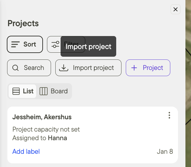 Examples:
| Import as a layer (max. 5GB): 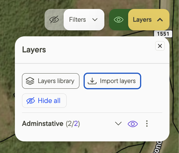 Examples:
|
Supported formats
Glint Solar supports many file formats. Files can be provided in their original format, however, shape files must be compressed as .zip
Vector Data
Glint Solar reads most common data formats, including:
- ESRI Shapefile (
.shp→.zip) - GeoJSON (
.geojson) - KML (
.kml) - KMZ (
.kmz) - GML (
.gml) - GeoPackage (
.gpkg) - ALKIS/NAS (
.xml)
Any file not using a WGS84 projection must contain information about which projection is used (CRS)
Some notes on formatting:
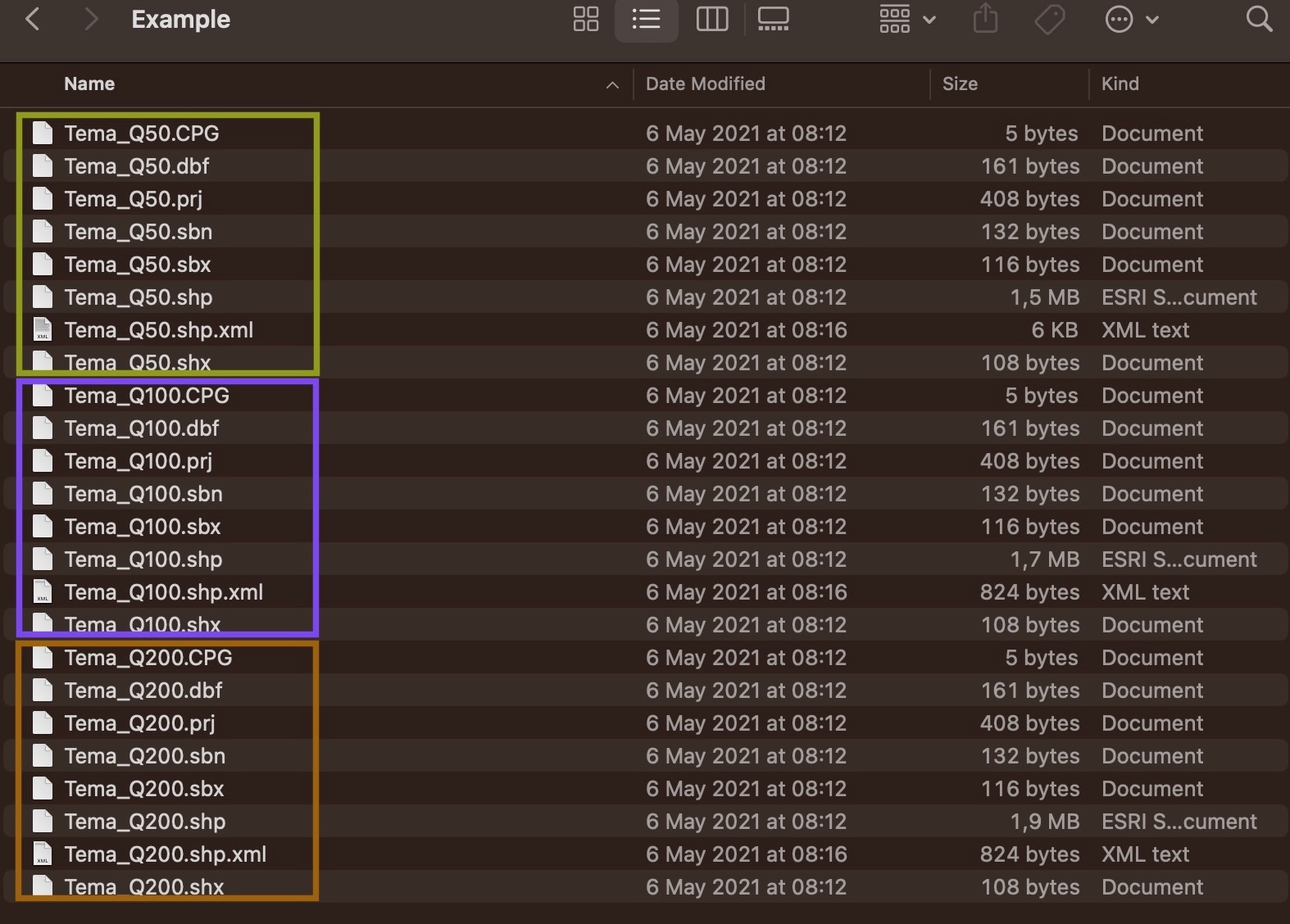
- Every Shapefile needs at least a .shp, .shx and .dbf to be valid. Combine these into a .zip file to upload them!
- If you have a folder with many shape files, for instance like so:
- foldername/
- name1.shp
- name1.shx
- name1.dbf
- name2.shp
- name2.shx
- name2.dbf
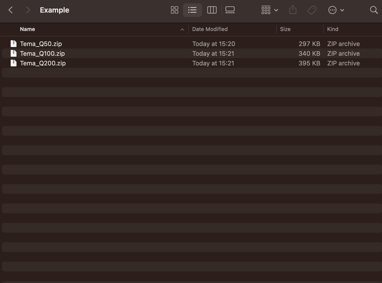
Then you need to take the files associated with each separate file and combine into a zip and upload separately. In the example above all files for “name1” would be combined into name1.zip and likewise for “name2”
After combining into zip, and removing the original files the folder looks like so:
Guidance on ALKIS/NAS file import
It is possible to import ALKIS/NAS (German cadastral data extract) upload using the Import layers function in Glint.
- The files come as .xml files
- Glint also accepts the .xml file extension, however, an import of any .xml file which is not a NAS file will fail (there’s no way to know if it’s a NAS file without opening the file). The function can be tested using a test data set from LDBV Bayern
- Processing takes a few minutes — longer than a geojson, kml or shp file import — but once it’s done, parcel geometries will show up with ownership information in the layer details.
- Note: the import only supports the default coordinate system: EPSG 25832 (ETRS89/UTM32) for the ALKIS/NAS file, which will be correct for most user files, but some may end up wrong. The reference system information is not contained in the data file. The reference system has to be known from the source.
For help in combining files into a zip, check out how it is done here: windows or mac
- ❣️Any other supported file format should not be in a zip, so for instance if you have a GeoJSON file that has been compressed into a zip file, first extract it then upload it.
Raster Data
Glint Solar reads the following data formats:
- GeoPDF (
.pdf) - GeoTIFF (
.tif→.tiff) - JPEG 2000 (
.jp2)
Note that these files must be georeferenced before importing to Glint. You can watch a video tutorial on how to do this below.
We would also be happy to assist you in georeferencing files if needed! Please reach out to us for help!
Additional resources
Do you want to import a project instead of a layer? Read the article about importing projects here.
Do you want more details on how to import data as a layer? Read about this here.